After failing to finish the Big Seki loop last year and arriving home slightly disappointed at having to cut the trip short. The idea was floated and hatched to do the John Muir Trail this year solo. I did as much reading and research as I could and applied for permits in January 2017. I received a rejection email each day for 21 days. (it is a tough permit to get) Discouraged but willing to adapt I hatched a plan to start at a national forest trailhead 26 miles south of Mt Whitney and hike the JMT +26 miles northbound (nobo) from there. I secured my permits in February and watched as the winter of 2017 piled historic levels of snow on the Sierra.
June rolled around and people were still skiing on Mammoth Mountain.
 |
| Us at Mammoth Mountain June 20. |
Late June and Pacific Crest Trail Hikers were skipping the Sierra for the time being due to the snow level... I was supposed to start July 15th. I was nervous that my plan would again be foiled. I watched the PCT hikers instagrams and followed the 2017 JMT facebook group constantly checking for updates as to whether the sierra would be passable. I scoured satellite images hoping to see a sudden reduction in snow levels at the higher elevations. About 1 week before I was scheduled to start reports started coming in of people successfully completing the Sierra without too many delays and special gear needed. I bought some Micro spikes for traction studied my emergency exit trails just in case and decided I was going to go for it.
July 14 2017 Day 0
Teresa and the kids drove with me up to Lone Pine where I picked up the permits. I was quite nervous about the whole thing. We ate lunch at the Alabama Hills Cafe and drove the steep and winding road up to Cottonwood Creek trailhead at 10K ft. The kids loved being up in the trees and helping me set up my tent at the backpackers camp. They even helped put together a pile of sticks and pine cones in the fire-pit.
They had a 3+ hour drive home, Teresa was a bit nervous about driving the steep switchback road down the mountain and it was getting late so we said our goodbyes and the family drove home.
 |
| Goodbye for 2 weeks. |
I set out for a quick 4 mile hike to help me get acclimated to the altitude. I didn't see any snow at all and felt good. I arrived back at camp and the backpackers camp was suddenly full of people. I eavesdropped on a bunch of conversations and the group next to me was setting out nobo on the JMT tomorrow too so I went over and tried to make friends. Their names were Steve, Lynn and John and they were from South Carolina and Illinois and had been college buddies. They were talking about a group of women who had set out that morning and looked like they were dying in the first 5 miles. They suggested that they were going to go 20+ miles to Crabtree Meadows tomorrow and that way they would do Mt Whitney on day 2. I had planned to do more like 12 miles and stop at Perrin Creek but was going to see how I felt. They all looked at me like a wimp. At that time another 2 guys from San Fransisco via India showed up. They were setting out the next day like the rest of us. The college guys said they would do the trail in 14 days. I had planned 16, and the others said 18. We agreed to keep and eye out for each other. I ate a subway sandwich and crawled into my sleeping bag. The night was AWFUL. A boy scout troop showed up at 10pm and made a huge racket all night. A herd of cows screamed all night in the meadow behind the camp and I was feeling pretty nervous about the whole thing.
July 15 2017 Day 1.
I was up at daylight, packed, fed and on the trail by 6:15. The college buddies had already left and the San Fransiscans were about to leave. I started walking towards Cottonwood Pass. It was 4.5 miles of uphill with a pack filled with 4 days of food. I felt great in the cool morning air and when I reached the push to the pass I had caught up to the college guys already. They looked like they were going to die. One of them said "this is HARD" I replied " This is what we're here for" and hiked right by. That was the last time I ever saw them. I must admit I felt a bit of pride. They were trashing other hikers the night before, talking big and looking down their noses at everyone else. I made it over the pass still feeling great and started the walk to join the Pacific Crest Trail which would take me to Perrin Creek.
 |
| The top of Cottonwood Pass looking west towards Perrin Creek. |
 |
| Crabtree Meadows. There is a deer out there. super tiny |
July 16 2017 Day 2.
I woke up a bit late ate breakfast packed only the things I'd need for a day trip in my backpack, folded down the tent but left it in place and set out towards the summit of Mt Whitney (the official start/ end of the JMT depending on direction you are hiking). I felt pretty good considering the big miles the day before. My pack was light and I was familiar with this section of trail having done it in 2015 on the HST.
2015 had been a drought year this year Timberline Creek was a river/ lake. The trail was a constantly flowing muddy creek, and there was snow.

 |
| That flowing creek is the trail. The JMT. |
 |
| Sunrise over Mt Whitney. |
 |
| Guitar Lake 2017 |

The ice was firm my spikes stuck and I made it. I was now really feeling winded. I reached trail junction where the Mt Whitney trail from the Whitney Portal on the east side joins at 13,500 ft and started towards the summit. The eastern trail is the way people usually climb Whitney so the trail got really crowded with unprepared hikers who looked like death. After the pinnacles the trail disappeared into a giant snowfield. People had left Cairns scrambling up a steep ridge and it was clear that this was the route this year. The steepness, altitude and lack of a trail got me really winded on this section but eventually I could see the hut and knew I'd reached the top.
 |
| 2nd time. In 2015 this was the end of a trail. in 2017 only the beginning. |
July 17 2017 Day 3

From my trail journal:
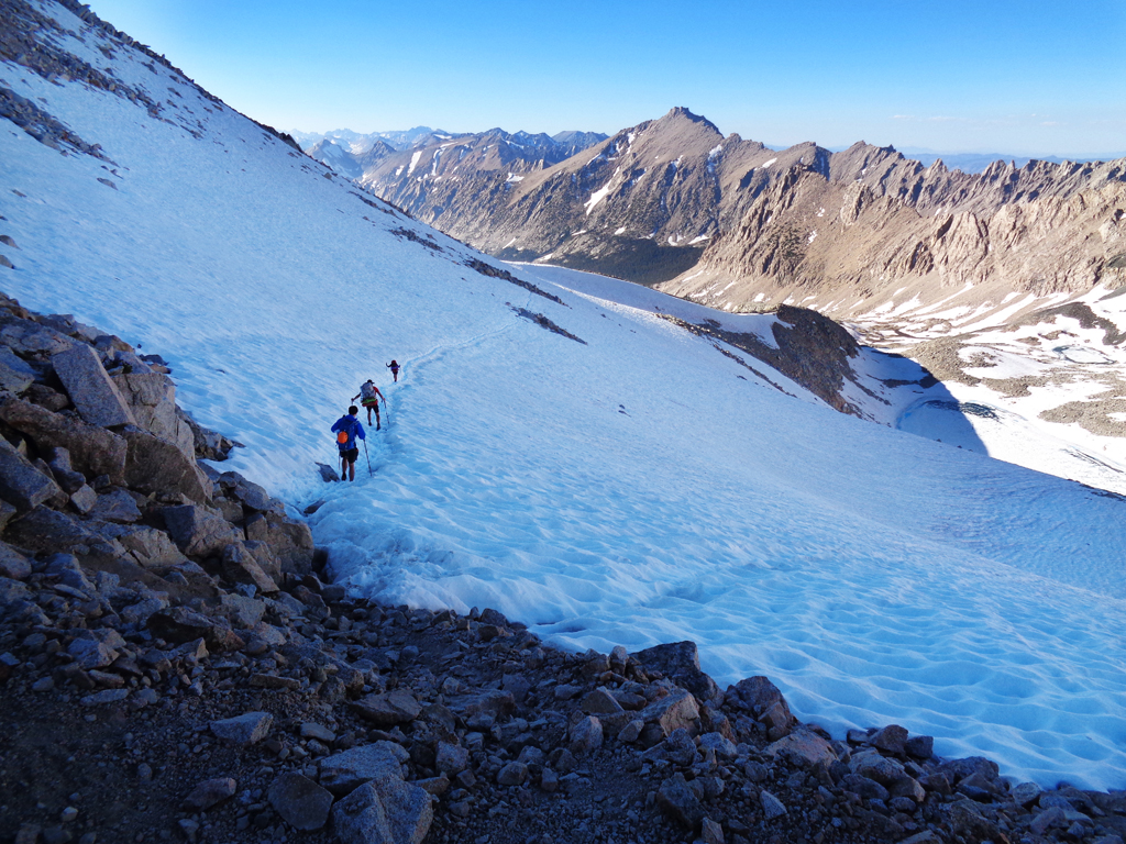
"So. This day was hard, exhausting, fun, epic, amazing and incredibly beautiful. Started at Crabtree attempting to make Tyndall creek for camp. Hiking was good, felt strong. Came across the Indian dudes from day zero named AKY and ??? They were super nice and we chatted and played leapfrog a bit. They skipped Mt Whitney which is how they got ahead of me. They mentioned that they were planning on camping at a lake right below Forester Pass. That sounded like a good idea so I changed my plans. I reached Tyndall by about 1 o'clock and ran into Mike while trying to decide the best way across the creek. There was a note from a ranger saying 1 mile up easier crossing so I went that way. He didn't. At the crossing I met John, Savanna and ??? They were nice and said that they were doing Forester pass that afternoon. I thought that sounded insane ate lunch then kept hiking. I reached Bighorn Plateau and was in awe. It was so beautiful, like a moonscape w/ blue skies and lakes."


 |
| The tiny low point in the center of this shot is Forester Pass 13,200ft tall. The highest pass on the PCT. |
"Eventually I got to the "Lake" that I was going to stop at and it was snow everywhere, not even a single site. Mike, John Savanna, 2 Spaniards and one other John were all there trying to figure out how to get up Forester. I pointed out the notch and we watched a guy come down. Then everyone started going. I was stuck w/ no camping so I joined b/c it seemed like a good strong group. It was a crazy pass 13,200ft, highest point on the PCT. At the top I met Mikes friend "Stinky" who had hiked the Appalachian Trail last year. The backside of Forester was all snow but there were clear tracks so we started down. "
 |
| Halfway up Forester Pass. That snowfield is where I had planned to camp with Aky and ??? There's a lake under that ice somewhere. |
 |
| Looking north from the pass. |
 |
| Some of the posse headed down from Forester |
 |
| My butt tracks. I tried my hand at Glissading. It's basically sledding on your butt. It's awesome. Best way down a mountain for sure. Even if you do rip your pants. |
"A couple of times I Glissaded which is super rad. Snow hiking was fun and exciting but tiring. Near the bottom Mike and Stinky invited me to camp with them. I'm trying to be open so I said sure. They were headed to treeline and I needed to stop for water so they went ahead. On my way down there I was crossing a log bridge and I make it across only to slip on the muddy bank and come down hard on my left side. I was muddy and wet and bruised but o.k. no major cuts or bumps. Eventually I found Mike and Stinky. We made camp had a fire and chatted until midnight. I slept well"
Like I said this day was epic. 18.95 miles, Forester pass, glissading, snow hiking. I was even more ahead of schedule now. I hadn't planned on doing Forester until the next day. I never found out what happened to Aky and ??? I never saw them after that day.
July 18 2017 Day 4
I was scheduled to meet Dylan this day at the Charlotte Lake/ JMT junction. When I was first planning the trip he had planned to come join me for 5 days from there to Bishop Pass. All of the snow had convinced him not to do that so instead he very kindly offered to meet me and carry up a resupply of food, toiletries and other disposables. His incredibly kind offer had meant I only had to pack 3.5 days of supplies at the beginning instead of 8. He was going to meet me in the afternoon and I was way ahead of schedule so I had a slow lazy start. It was a 5 mile climb to the junction. I got there early did laundry and had a hiker bath in the pond that had taken over the junction.
 |
| The sign is at the trail junction I was supposed to meet Dylan at. |
7.79 miles hiked. Lost Mike and Stinky because of short day and resupply.
July 19 2017 Day 5
This day was really hard. I woke up and had a hard time with breakfast because everything was frozen. Eventually started hiking and made Glenn Pass. Dylan only had YakTraks (not as grippy as Micro-Spikes) so it was a bit sketchy for him. With my spikes I was fine. He took a couple photos of me that showed the slope and ice but I asked him not to send them to Teresa, just send her this and tell her I'm doing great. I was doing great and I didn't want her to worry more than she already was. Now I can't find the ice photos...

At the top we met a couple guys named Bryce and Andrew. They were also doing the JMT northbound. I said goodbye to Dylan, thanked him and set off down to the Rae Lakes. I had it in my head that I'd had such a short day yesterday that today I was going to do 2 major passes and put myself ahead of schedule again, so I booked it down with a few glissades thrown in. The Rae Lakes were beautiful and the creek crossing were wet up to my thighs.
 |

 |
| Southern Rae Lake. |
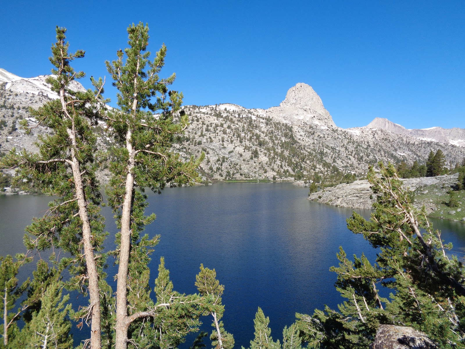 |
| Fin Dome and Rae Lake |
I set off to try and make it over Pinchot pass by evening. It was all uphill and 5 days of hiking was catching up to me. I was SLOW, wet, chaffing and not feeling it. I made it to near Twin Lakes and decided to call it a day. I tried to set up my tent but I was above the treeline and the soil was too hard to get a stake into the ground. My backpacking tent needs to be staked to set up correctly. In previous situations I'd found ways to anchor the tent with rocks and tie it to bushes etc in un-stakeable ground. This day I was just too tired and discouraged. I had really wanted to make Pinchot and just didn't have it in me. I set up a cowboy camp and massaged my aching knee, took some Advil and went to get water at the creek. One the way back 2 young bucks crossed the trail not more than 30ft from me. The were so close I could see the felt on their antlers. I made my favorite trail/ ziploc dinner of Knorr Mexican rice mixed with dehydrated chicken, peppers, beans and other veggies. As I was eating I consulted the maps and the Guthook JMT app and discovered that I should be able to do Pinchot Pass and Mather pass tomorrow. All of this made me feel slightly better. I went to bed and slept great. I rolled over a couple times during the night and realized that the greatest thing about cowboy camping is seeing the milky way at 1 am from your warm sleeping bag.
14.18 miles (not nearly what I'd hoped for)
 |
| The hot, dry, exposed uphill after Woods Creek looking back towards Glenn Pass |
 |
| Woods Creek Falls. |
Ryan
No comments:
Post a Comment